Tuesday, October 31, 2023

The politics of guns in Maine, before and after a mass murder

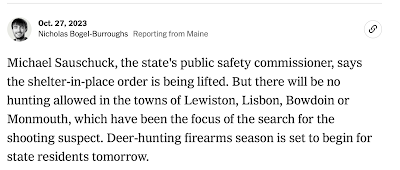
New York Times screenshot from Oct. 27, 2023

Maine has been very much in the headlines for nearly a week, prompted by the nation's worst mass murder of 2023.  It began at about 7 pm Eastern time on Wednesday night, October 25, when Robert Card, 40, entered a bowling alley in Lewiston (population 37,000) with a semi-automatic weapon and began shooting.  Less than half an hour later, Card entered a bar and grill and used his weapon to kill and wound many others.   

Lewiston, with a population of 37,000, is the state's second largest city (after Portland), and it sits across the river from Auburn, population 24,000, and the county seat of Androscoggin County.  Based on the size of the population cluster, the area hardly sounds rural, but rural is a descriptor that's often been used in coverage of these events.  More often still, I have heard the word "forested" used, which is perhaps more salient with regard to the hunting theme, which I'll unpack below. 

I didn't know much about Maine's gun laws when this disaster began to unfold in the media, but we were soon to learn more.  In short, Maine's gun laws are quite lax, in part because of the state's culture, which values self-reliance and enjoys hunting, two things that happen to be related, to at least some degree.  

In the days since the mass murder, hunting has been very much a part of the story of how officials have responded to this tragedy.   For example, even after the shelter-in-place order was lifted on Friday, hunting was prohibited in the towns of Lewiston, Lisbon, Bowdoin, and Monmouth.  As the New York Times reported (see screenshot above), deer-hunting firearms season had been scheduled to begin on Saturday, Oct. 28, 2023, but it was initially postponed after Wednesday night's events--at least in the Lewiston-Auburn area

New York Times Screenshot, Oct. 27, 2023
following the discovery of gunman Robert Card's body 

We've also seen plenty of mentions of the state's "gun culture" in coverage of Wednesday night's events.  One New York Times headline was "After Shooting, Maine Senators in Spotlight on Guns," which included this tidbit.   

The carnage in Lewiston came as a shock to Maine, which the F.B.I., in a statistical update on crime Monday, called the safest state in the country. It also has one of the largest percentages of gun ownership.
The story quotes U.S. Senator Angus King (I-Maine):  
Our state has a long history of responsible gun ownership.

But the most momentous political statement about guns came from Maine's congressman for the state's second district, Jared Golden.  That district is massive, stretching from Lewiston all the way to the Canadian border.  (The state's only other district, the 1st,  includes Portland, just 40 miles south of Lewiston, and points south to Massachusetts). Some would say that Golden, a former Marine, is barely a Democrat.  Certainly, he is a centrist who has straddled a fine line between the two parties--and between rural and urban interests--with his constituents.  That is reflected in these August comments about student loan forgiveness, which he vigorously opposed as in the interests of elites and not in the interests of working-class Mainers who choose not to go to college.  

Well, less than 24 hours after the shooting, Golden, who grew up in Lewiston and attended Bates College there, grabbed the headlines by doing an about-face on his previous position on assault weapons.  As the New York Times reported it, Golden "stunned constituents in his traditionally pro-gun district by "declaring that it was time for him “to take responsibility” for his “failure” to back a ban on assault weapons, “like the one used by the sick perpetrator of this mass killing.”  The full comments, as reported in the (Portland) Press-Herald follow: 

I have opposed efforts to ban deadly weapons of war, like the assault rifle used to carry out this crime. The time has now come for me to take responsibility for this failure, which is why I now call on the U.S. Congress to ban assault rifles, like the one used by the sick perpetrator of this mass killing in my hometown of Lewiston, Maine.

For the good of my community. I will work with any colleague to get this done in the time that I have left in Congress.

Interestingly, Senator King  acknowledged Congressman Golden's "courage" in shifting his position on assault weapons, but neither he nor Maine's other U.S. Senator, Susan Collins, changed theirs.  In this NPR story, Collins is quoted as suggesting that the state's "yellow flag" law should have caused the shooter's guns to be seized.  We've since learned more about the failure of officials to act adequately on multiple reports that Card was having mental health challenges.

Back to hunting:  It's interesting that a significant aspect of the local news once Card's body was found Friday night was that hunting could resume.  It merited this "public security alert."

Screenshot from New York Times breaking news stream
at 7:55 PM Pacific, Oct. 27, 2023

Cellphones across Lewiston area just dinged with a public safety alert:  "The search is over for Mr. Card.  The caution is over.  Hunting may resume."

Postscript:  On Oct. 31, the New York Times reported under the headline, "After Mass Shooting in Maine, No Clarity on Whether Gun Laws will Change."  Here's a salient excerpt: 

Maine has a strong hunting tradition and high rates of gun ownership. It has also long had one of the lowest murder rates in the country. There were 19 firearm homicides in the state last year — just one more than the number of people who were shot to death in Lewiston in a single day. (Guns were also used in 159 suicides last year, out of 183 total gun deaths in the state.)

Monday, October 30, 2023

Tribal co-management of National Parks (Part IV): Big Cypress National Preserve

For the last installment of my National Park co-management series, I'm looking at Big Cypress National Preserve. Big Cypress covers more than 700,000 acres in southern Florida, north of the Everglades National Park. 

Big Cypress National Preserve (Antonio Chavez/Wikimedia Commons)
Big Cypress was the first National Preserve in the United States (Glacier Bay, another National Preserve I covered here, was a National Monument but became a National Park and Preserve in 1980). Parkland designations have a variety of meanings, but in the case of Big Cypress, the "preserve" designation didn't only preserve the swampland, it also preserved the preexisting land uses. Indigenous peoples thus retained their traditional use rights, as did other folks living in the swamp.

Big Cypress is the traditional homeland of the Calusa, Creek, Seminole, and Miccosukee peoples, among others. They have lived in Florida from time immemorial. Before contact with the Spanish, there were many nations and many peoples living throughout the state. After the arrival of the Spanish, disease, violence, and the slave trade decimated Florida's Indigenous population. Those who remained coalesced into broader Creek and Seminole groups. 

During Andrew Jackson's presidency, Congress passed the Indian Removal Act, which invalidated earlier treaties the United States had made with Florida Native peoples. The U.S. Army invaded Seminole territory and marched thousands of Seminole, Creek, and other Southeastern Indigenous people west to land that is known today as Oklahoma. The Seminole fought back for decades, eventually taking up residence deep in the Florida swampland. The US Army assumed that they would die there, and eventually abandoned the fight. 

Instead, the swamps of southern Florida have allowed the Seminole and Miccosukee Tribes to thrive. The Seminole and Miccosukee have several reservations near Big Cypress and enjoy statutory rights to use the federal swampland as they traditionally would. Today, the Seminole Tribe of Florida is likely the wealthiest Tribe in the country. It operates 7 casinos in Southern Florida and owns Hard Rock International, the parent company of the Hard Rock Cafe franchise. Forbes Magazine valued the Tribe and its business holdings at $12 billion. The next richest Tribe in the United States, the Shakopee Mdewakanton Dakota in Minnesota, have an approximate net worth of $2.7 billion.

The homelands of the Seminole and Miccosuke peoples in Big Cypress were first protected because of a massive, futuristic airport project. In 1968, two years before the passage of the National Environmental Policy Act (NEPA), which requires federal agencies to complete environmental impact surveys on proposed projects, the state of Florida proposed the construction of the Everglades JetPort, an airport for the future. Five times the size of JFK International Airport, the Everglades JetPort was designed for supersonic flight. Boeing was working on an American answer to the Concorde, and the JetPort was  to have six runways to land those jets. It would connect to both Florida coasts through a 1,000 foot-wide transportation corridor on either side, capable of "handling tracked air cushion vehicles traveling at speeds of 150 to 250 miles per hour."

As construction began, the undersecretary of the Interior asked Dr. Luna Leopold, the son of Aldo Leopold (author of A Sand County Almenac), to conduct the state of Florida's first Environmental Impact Survey. Dr. Leopold found that the construction of the airport would almost certainly destroy Everglades National Park. The proposed runways would be only six miles north of the Everglades' northern-most boundaries, destroying vital waterways and wildlife corridors for endangered species like the Florida Panther.  

In order to build the airport, Florida would have to fill in thousands of acres of swampland. The loss of swampland would have almost completely destroyed the water flow into the Everglades. Additionally, the Big Cypress swamps allow the  aquifer that provides the drinking water for all of South Florida to re-fill. Building a giant airport would not only jeopardize that process, it would potentially contaminate the ground water with hazardous substances commonly used at airports, like jet fuel.

The reaction to the environmental impact survey was enormous  most of it in opposition to the airport. Construction on the JetPort halted in 1970, after only one runway was built. The federal government acquired the land and established Big Cypress National Preserve in 1973 by an act of Congress.

Perhaps because of the time period in which the Preserve was established, the amount of public support for the parkland designation was remarkable. The project was supported by environmentalists, Tribal interests, and everyone else living there. In addition to the Seminole and Miccosukee, the swamps of south Florida were home to many white settlers who lived off of the swampland. These people, sometimes called Florida Crackers or Gladesmen (or women), were instrumental in the establishment of the Preserve. 

Unlike the other parks I've covered in this series, which were either owned by Tribal Nations or were federal land at the time they became parks, Big Cypress was a conglomeration of private land rights that were purchased expressly for preservation. The designation of National Preserve, the first in the country, preserved preexisting land uses, including Traditional Seminole and Miccosukee practices, as well as fishing, cattle grazing, and oil and gas exploration (note, however, that no new grazing permits are being issued).

What is most remarkable about this project is that it predates quite a lot of important environmental regulation. Much of the Clean Air Act was passed the same year the JetPort project died --1970. NEPA was also enacted in 1970. The Clean Water Act was enacted in 1972. The Endangered Species Act was enacted in 1973. Tribal interests, conservationists, and the people of Florida came together to prevent the construction of this airport before many of the conservation mechanisms we would use today existed. 

They were able to protect Big Cypress using older tools. 

Recently, the Collier Resources Company bought permits for oil exploration in Big Cypress. They gouged hundreds of miles of trails into the park to search for oil and gas reserves using a sonar-based system. Environmental organizations and the U.S. Army Corps of Engineers have spoken out about the damage the exploration has done. The National Parks Conservation Association is campaigning for the government to acquire Big Cypress's mineral rights to prevent any future extraction. 

This is the last post in my series about co-management of National Parks, so I want to offer a few over-arching observations. More so than I expected, co-management is a story of survival and of growth. The four parks I looked at were based on the four parks mentioned in this 2022 speech. Each park is unique and beautiful. Each co-management agreement is similarly unique. 

John Leshy spoke about the unique place that public trust land has in American politics at the California Lawyer's Association's Environmental Law Section Conference this year. (He covered similar topics in this interview) He argued that it can be a uniquely bipartisan issue. The creation of Big Cypress seems to exemplify that. The project was helmed by then-Senator Lawton Chiles, a Democrat, but had broad support across Florida.

I learned from Professor Leshy's talk that co-management is not defined anywhere in public lands law. He implied that this made further proliferation of these agreements more difficult. Though I don't doubt the difficulty of negotiating these agreements, it's possible that the process might make the management agreement fit with each ecosystem better. In each park, the co-management agreement has been different, according to the history, the landscape, and the interests of the Tribe(s) involved. There is no one-size-fits-all solution to land management in the United States. That's a good thing. 

Sunday, October 29, 2023

Orick: the gatekeeper and poacher of the redwoods

Every year, expensive cuts of redwood are used to make trinkets, furniture, luxury car consoles, and other goods. A significant portion of this costly timber used to make these items is poached from the Redwood National and State Parks in California. Much of it comes from in and around a town named Orick

Orick sits at the base of the Redwood National Park in Humboldt County, California. Once a place with a booming timber industry, it now has a high poverty rate, widespread drug use, and a dwindling population. Once home to 3,000 people, its population is now estimated to be just 300

Orick's undiversified economy is surprisingly supported by a lucrative underground tree poaching economy. Many Orick residents have turned to illegally harvesting redwood burls from their neighboring protected lands. Burls are the bumpy growths on redwood trees that form following trauma such as lightning, fire, and fungal infections. When injured, redwoods direct their nutrients and energy into healing this trauma, which results in the burls. The burls thus contain a lot of genetic material, making it likely for a tree to sprout from the rough bump. Cutting a burl does irreparable harm, weakening the foundation of the tree and making it susceptible to disease. More consequentially, it lessens the chance for the tree to reproduce

Tree poaching in Orick used to involve only dead redwood logs. The regular theft of redwoods began only about fifteen years ago. In 2006, the San Francisco Chronicle reported on authorities' concerns that poachers would begin chopping down live trees as the number of dead logs decreased, and this is exactly what happened. The U.S. Forest Service estimates that one in ten trees cut in national forests is poached, and the Redwood Park rangers are calling the poaching a "crisis." Investigators have discovered chunks of illegal burlwood along the 101 Highway from Eureka to Crescent City. 

Poachers are primarily motivated by money. These chunks of wavy burl hold significant financial value and a single slab of redwood can fetch a couple thousands of dollars. Poachers can easily drop their fresh loots off to local buyers in the area who then use the wood to make an array of luxury items. Burls are smoother and easier to carve making them ideal for sculptures and furniture. 

Poachers often work in teams and sneak into the park during the middle of the night. To lessen their chances of being caught, rainier weather is preferred during these operations. Poachers use chainsaws to cut into the trees and then haul away large chunks of redwood. From time to time, poachers are caught and charged. They are often fined, banned from the park, and ordered to complete community service (Read about one Orick poacher's sentence here.) These sentences, however, are sometimes not enough to stop poachers from coming back

With few economic prospects left in Orick, burl poaching has been a quick way for residents to make money. Orick had reached its peak as a logging town after World War II. During that time Orick had four sawmills, unionized timber jobs, and was a bustling town with bars, restaurants, and shops. This was also the period when many redwoods were logged––two million acres of coastal redwood were diminished to 300,000 acres. By the 1960s, the environmental impact of the logging industry was clear. In an effort to protect the remaining redwoods, environmentalists pushed for action, and in 1968, President Lyndon Johnson signed a bill creating the Redwood National Park. 

Timber companies blamed environmentalists for their downfall and the effects of deindustrialization that ensued. Officials told the town that while the timber industry was collapsing, tourism to the area would boom. But this did not happen. Lyndsie Bourgon, author of Tree Thieves: Crime and Survival in North America's Woods, told NPR:

Orick finds itself ensnared in a vicious circle: its reputation for drugs and unsightly poverty deters anyone who might want to invest in making it a permanent home or a place where tourists might want to stay.

In her book, Bourgon argues that tree poaching is the product of desperation: people with a deep-rooted attachment to Orick are left with limited options. One poacher likened himself to Robin Hood, telling Bourgon, "Robin Hood was just taking care of his and his own." 

Read more about Orick here and timber poaching in California's national parks here

Thursday, October 26, 2023

Whose land is it anyway? Why South Australian farmland has no protection against mining.

As it currently stands within the 1971 Mining Act of South Australia, farmers have no right to veto mining activities over their land. When extractive minerals are found, or believed to be located, on farmland, the land owners are required to hand their land over to the government, where it is sold on to mining corporations. Why? Because section 16 of the Mining Act specifies that all minerals rights are held by the Crown (the governing authority of Australian law at both a State and Federal level). 

All decision making power with relation to mineral lies with the Minister for Energy and Mining, meaning they have the ability to grant mining related licences over private land without needing to seek permission from the land owner. This inequitable balance powered by statute has, and will, continue to inflict harm upon the farming industry throughout South Australia. 

A lack of power to prevent corporate destruction to farmland is the sort of nightmare fuel that breeds a lack of trust between the government and its people. I guess the most appropriate question to ask in this situation is, if you can't say no to someone ripping up your land, then is it really your land at all?

I have very few bad things to say about South Australia. It has been my home for almost all of my 24 years of life. It is host to incredible wine regions, farm and river land, outback spectacles and the second biggest annual arts festival in the world. However, when it comes to the South Australian government and its undying love for mining, there is no possibility of coming in between them, regardless of what harm may ensue. This is something that makes my blood boil to a level I simply cannot put into words. 

To try and give you an idea of how highly valued mining is within South Australia, in the March quarter of 2023 alone, the government spent AUD$64.2 million on mineral exploration (scouting and searching areas for extractive minerals). This broke an 11-year long Australian record of $61 million, which was also set by South Australia in the December quarter of 2012. 

While $64.2 million sounds like an obscene amount of government money to spend on just the exploration purpose, South Australia is a treasure trove of undiscovered minerals and highly valued finite resources. Evidence for the presence of such resources is Olympic Dam: one of the most significant mineral deposits in the world.

Olympic Dam (owned and operated by BHP) is located around 350 miles from the state's capital, Adelaide, it has roughly 435 miles of underground roads that run throughout the mine and is estimated to be worth anywhere between AUD$4.9 - $5.4 billion according to the Australian Financial Review. Olympic Dam is such a significant site that the town of Roxby Downs was purposefully established and built to support the mine. 

At its most successful, the South Australian mining industry generated AUD$7.3 billion in a single financial year, meaning it holds an undeniably significant value to South Australia's economy. With revenue like this, it is easy to understand why the government would hold such a destructive industry close to its heart.

It's hard to imagine that another single industry could provide a more influential value to a State than mining does. After all, mining's where the money is, right? To a certain extent yes, but South Australian farmers would argue otherwise.

In the 2021/22 financial year, South Australia's agribusiness and primary industries^ generated $10 billion MORE than the mining industry did at its peak. Coming in at a whopping AUD$17.3 billion in revenue, South Australia's agricultural industry increased its revenue by almost $2 billion in a single year (after the previous all time high of $15.4 billion in the 2020/21 financial year). Within this enormous figure, field crops came in as the biggest contributor with $5.6 billion, followed by livestock with $4.1 billion and wine with $2.4 billion. 

An absolute necessity for the agricultural industry is arable farmland. Healthy top-layer soil and everything below is the key to successful crop growth. Crop growth is not just used for harvesting food, but also animal feeding, grazing land and vineyards. Without healthy soil, there is no possibility for the land to be used for agricultural purposes. 

When privately owned farmland is purchased by mining corporations, there is a statutory requirement that mining corporations are required to have an approved Program for Environmental Protection and Rehabilitation ('PEPR') prior to the commencement of any extractive project. These programs are designed to promote a greater level of environmental responsibility, by requiring corporations to restore land after an extraction project has completed. 

While there are legislative mechanisms for enforcement of these programs, the penalties in place for non-compliance are shockingly insignificant compared to the revenue mining corporations generate. Failure to comply with a PEPR will result in a maximum civil penalty of AUD$250,000. Using Olympic Dam as an example (but note they are governed by their own statute), it would take BHP just under 2.5 minutes to generate the $250,000 needed to cover the penalty (calculations below). 

So why does the government impose such pathetic penalties? Why does the government place a higher value on land use for mining over agriculture? It's simple: the government is entitled to royalties from all extracted minerals due to Crown ownership. 

In the 2019/20 financial year, the South Australian government received AUD$311 million in mining royalties. While I understand the government needs all the financial support they can receive, this also showcases an absolute inability for sustainable, long term economic consideration. Profits now, will lead to detriment for the future of South Australia's economy if farmland continues to be surrendered for mining practices.

In my humble opinion, Western Australia is operating decades ahead of everyone else. Section 29 of the Western Australian Mining Act affords land owners the power to veto any form of mining activity proposed to affect the surface of their land. This statutory protection not only protects Western Australia's agricultural industry and economy, it also protects the wellbeing of its farmers. This is a legislative provision that while being small, hands over significant power to farmers and more importantly, demonstrates to them that their government cares. 

So where should South Australia go from here? Allowing farmers the power to veto mining activity over their land is the bare minimum that can be enforced to protect South Australia's agricultural industry. Once farmland has been contaminated by mining practices, it is near impossible to recover the land to its original condition. The practice of mining transforms farmland into a finite resource - once it has been used for mining, it will never be useable for agricultural purposes again. 

These farmers need a safeguard. They need their government to listen to them and support them. The South Australian government needs to walk away from their money hungry attitudes and begin to look after the agricultural powerhouse they are privileged to have at their finger tips. 

What I would say to the government if they could hear me - shame on you and your ignorance. Your lack of awareness on the destructive nature of mining is simply embarrassing. Farming matters. The sooner you wake up and realise this, the better off our State will be. 

If you wish to read more about the importance of Australia's agricultural industry, I explored live animal exports in Western Australia, in previously published posts available here and here

*******

^'Primary industries' is the collective term used for South Australia's field crops & grains, livestock, wine, horticulture, forestry, dairy, seafood, wool and animal feed industries. 

*******

Calculations:

For the 2021/22 financial year, BHP reported earnings of AUD$57 billion.  

The mine operates 24 hours a day, 365 days of the year.

This generates approximately $156 million per day, $6.5 million per hour and $108,00 per minute.

108,000 x 2.5 = 270,00 

Therefore, just under 2.5 minutes to earn enough to cover a $250,000 penalty. 


Wednesday, October 25, 2023

Agriculture and the 2023 Farm Bill are opportunities for climate action


Over the weekend, I had the good fortune of attending a seminar titled “Farming For Our Future” at the Yosemite Environmental Law Conference. The panelists illustrated the ways and extent to which agriculture, forestry and food systems contribute to climate change and environmental degradation. They also explained how U.S. policy choices have led us down the path of harmful agriculture and how policy changes can make a difference.

I left the panel feeling excited and hopeful about how lawyers and policymakers can address climate change by paying more attention to rural spaces and agriculture, and so I decided to bring a brief overview of what I learned to the blog.

The Problems

Agriculture and forestry contribute about 9 percent of California’s greenhouse gas emissions, while the national figure is about 11 percent. Food systems worldwide contribute to one third of global emissions.

The panelists explained that in California, these agricultural emissions are predominantly caused by manure processing and livestock enteric (aka cow burps), followed by emissions from growing and harvesting crops and fuel combustion. Livestock further contributes to climate change due to the scale of the industry’s use of rangelands, which make up 21 percent of all land in the U.S. and do not sequester carbon.

Another large source of agriculture emissions in California is rice. I’d previously known rice to be a water-intensive crop with the redeeming factor of creating good habitat for migratory birds given the widespread loss of natural wetland habitat. This weekend, however, I learned that the flooded-field method of growing rice poses an additional climate challenge: The water that sits in the field becomes anaerobic and emits substantial amounts of methane.

Sacramento Valley rice fields, which dot most roads leading in
 and out of Chico, where I grew up. Photo Credit:Laretta Johnson

Our current agricultural practices pose environmental problems beyond intensifying climate change. The panelists also talked about degradation and loss of soil caused by, among other things, lack of cover cropping and use of nonorganic fertilizer and pesticides. Fertilizer use and manure also lead to water contamination throughout the Central Valley and other areas of the state and country.

The list of environmental issues within agriculture go on, and one could easily dedicate a blog post to each one. But rather than attempt an exhaustive list of environmental challenges, I want to address both some roots of the issue and opportunities for policy change.

Roots of Environmentally Harmful Agriculture

First, it’s important to note that agriculture can be, and traditionally has been, regenerative and sustainable. Panelist Professor Lingxi Chenyang spoke about pre-contact agriculture in the Americas, which was more biodiverse and tailored to the ecosystem in which it was practiced. Examples of this are fire-managed agroforestry, three-sisters practices, and wetland-based agriculture.

As Professor Chenyang explained, when European settlers arrived and colonized the land, they began to adopt commodity farming practices focused on exports and without real conservation practices. Federal policy and westward expansion then established regional agricultural specialization, like wheat in the great plains, corn in the midwest, cattle grazing in the west, and fruits and vegetables in California. As illustrated by the Dust Bowl, intensive monoculture degrades soil health and is harmful to natural ecosystems.

Congress passed the first iteration of the Farm Bill as part of the New Deal in response to low agricultural commodity prices following World War I, the Great Depression, and the Dust Bowl. Its main intention was to reduce surplus and raise crop prices, and it incentivized farmers to reduce production of certain crops. The Farm Bill, which is passed every five years, continues to have a huge influence on American agriculture and primarily supports and subsidizes large-scale commodity production rather than diversified, climate-resilient agriculture. You can read more about past farm bills' effects on land stewardship here.

Policy Solutions and Potential for Change

As the saying goes, inside every problem lies an opportunity. The opportunity to address climate change via agriculture policy is now, as the 2018 Farm Bill expired last month and Congress has yet to pass the 2023 bill. The call for the farm bill to address climate isn't new (see this 2012 blog post) but I wonder if the time and current administration may lead to real climate progress this time around.

If policymakers can influence the new Farm Bill to fund and incentivize climate-friendly practices, rather than continue to subsidize corporate commodity farms, the country could make big strides toward reducing agricultural emissions. This could also lead to more resilient farming practices in preparation for the climate disasters we are already locked in to.

As the Center for American Progress notes in this article, the “must-pass” Farm Bill is a unique opportunity for the typically gridlocked Congress to pass legislation addressing climate change. The Center recommends investing in conservation easements, climate innovation research and rural capacity building, among other climate-smart practices.

Some good news is that climate-resilient and low-emission, sustainable practices do exist – and they can provide ample food. Agroecological practices suggested by panelist Peter Lehner, managing attorney for Earthjustice’s Sustainable Food & Farming Program, include perennial crops, crop rotations, cover crops, no-till and reduced till practices, agroforestry and silvopasture, and organic fertilizer, compost and biochar practices.

However, according to Mr. Lehner, a USDA survey showed that 85% of farmers are unwilling to adopt structural conservation practices without outside funding. And from a business perspective, that makes a lot of sense.

One of my closest friends works for a resource conservation district in Virginia, where she helps administer grant money to farmers for adopting conservation practices. Farming has often been in a family for generations, and changing longstanding practices are a risk. Asking farmers to take such risks without financial and educational support is unlikely to move the country’s agriculture toward climate resilient and climate friendly practices, but the Farm Bill, as well as state policies, can be an avenue for providing funding, support and education for farmers to do so.

As Mr. Lehner pointed out during the panel, the federal government has recently invested heavily in sustainable transportation and energy. The next step can and should be sustainable agriculture.

Many thanks to the “Farming for our Future” panelists, Professor Lingxi Chenyang; Torri Estrada, Executive Director and Director of Policy at the Carbon Cycle Institute; and Peter Lehner, Managing Attorney for the Sustainable Food and Farming Program at Earthjustice. The panelists shared a lot of the knowledge, history and statistics used in this blog post.

Tuesday, October 24, 2023

Community radio in rural India

Community radio has been gaining notable traction in India's rural regions. One reason is that rural communities in India suffer from lower literacy rates compared to urban areas. In 2018 rural areas in India had a 73.5% literacy rate compared to 87.7% in urban areas, making radio an effective way to communicate with the populace. 

Community radio is partially used to "bridge the information gap between urban and rural audiences." During large-scale flooding in 2013, three radio stations set up communication lines to allow people to call for help and reach their loved ones. In 2019, Radio Surabhi was able to alert people that a cyclone had hit Odisha, and it shared information about available shelters. 

Community radio became even more important during the first COVID-19 lockdown when it broadcast educational programs and spread community health guidelines, vaccine information, and more. Multiple community radio stations have popped up around India since 2008, many of which are products of NGOs and community service initiatives.   

One community radio station in particular has received worldwide attention. Alfaz-e-Mewat, which is loosely translated to "voice of the Mewati people" or "rural voices of Mewat." Mewat is the cultural region that spans the state of Haryana, Rajasthan, and Uttar Pradesh. Mewat district, a rural district in the foothills of the Aravali mountains, was renamed Nuh in 2016 and is one of the 22 districts in the northern Indian state of Haryana

Located roughly two hours south of Delhi, India, Nuh is "home to the country’s ethnic Meo Muslims and a minority Hindu population" and in recent years “has emerged as a hub of cyber crime and sextortion rackets.” 

Alfaz-e-Mewat broadcasts for 13 hours every day in Hindi, Urdu, and Mewati, reaching 225 villages. Millions of people listen in from all over Nuh as Alfaz-e-Mewat, through the Indian airwaves, provides various programs including group therapy, education, women's empowerment, and entertainment. 

This community station started raising awareness about the COVID-19 pandemic shortly before the first outbreak in India. Alfaz-e-Mewat's program "21 din 21 baatein," meaning "21 days 21 topics," hosted experts to speak on the importance of frequent handwashing, accessing healthcare, and social and physical distancing. They also encouraged spreading positivity and encouraged their listeners to try yoga

One Alfaz-e-Mewat reporter spoke about the importance of radio in disseminating this information saying, "In my village of 250 families, only one house has a television. So, you can understand how important our role is as reporters in this region."

This region of India has some of the lowest female literacy rates in the country. Only 1/3 of women in Nuh are literate and 90% of Nuh women have dropped out of school before the age of 10. The norm in Nuh is reportedly that of early marriages and violence against women. In this region, where women are considered beneath their male counterpartsAlfaz-e-Mewat is becoming the voice of change. 

Alfaz-e-Mewat was started in 2012 by the S.M. Sehgal Foundation, a nonprofit the government funded with $18,000. What started as a community radio station to promote water conservation and agrarian practices now helps women get connected to resources if they are experiencing domestic violence. It also helps stop the spread of disinformation and is transforming the lives of their female listeners. 

Alfaz-e-Mewat receives around 50 calls daily, many from women experiencing health-related problems. Dr. Yadav, who occasionally answers questions on the radio station, reported that women in this region are often neglected at home, leaving many of them with severe anemia. Anemia, which is a shortage of healthy red blood cells to carry the necessary oxygen to one's organs, can lead to weakness and dizziness. Increasing one's iron and protein intake is an antidote so Dr. Yadav instructed a listener on how to make protein-rich meals out of available ingredients like chickpeas.

Bhagwan Devi, a 51-year-old listener, was inspired by Alfaz-e-Mewat to start a campaign to build toilets inside houses in her village. Noor Mohmamd, a 65-year-old from Mubarakpur Rawalki village, says he's a fan of the radio station, which has led him to change his farming practices. Women across the district have been impassioned to get educated, get jobs, and gain protection from violence

Community radio gives women a platform not only as listeners to get information, but as active participants" -Anjali Makhija, chief executive of S.M. Sehgal Foundation.


Saturday, October 21, 2023

The many hats of a rural child welfare attorney

I've dedicated my three previous posts (here, here, and here) to exploring rural child welfare systems. My own research spanning law review articles, child welfare journals, news articles, and legislative reports, however, took me nearly everywhere except the realm of attorney-specific reforms.

Attorneys can play vital roles in furthering child welfare; it was an attorney, working pro bono, who emancipated one of my own family members, saving them from a situation that would have satisfied any child welfare agency's criteria for removal.

So stories like Gabriel Fernandez's hit too close to home and shook me to my core. The death of eight-year-old Gabriel, at the hands of his own mother and her boyfriend, became the subject of a 2022 Netflix limited series documentary that exposed the shortcomings of the child welfare system.

So many adults failed Gabriel, and there were reports that the Los Angeles County Department of Children and Family Services falsified records of child abuse and kept him with his abusers.

If an urban child welfare agency had these glaring flaws, I wondered how such agencies managed in rural communities.

Casey Family Programs highlights some of the rural-specific barriers to child welfare: higher rates of child poverty, geographic spread that impedes access to social services and family members, limited infrastructure, fewer community-based services, and difficulties recruiting and retaining professional staff.

I wondered where attorneys fit into the child welfare equation and how they could better serve at-risk rural children in their day-to-day work.

Child welfare scholars Paul Johnson and Katherine Cahn provide a generalized approach in their article "Improving Child Welfare Practice Through Improvements in Attorney-Social Worker Relationships."Johnson and Cahn push for cross-training between attorneys and social workers to develop better working relationships for more effective and efficient child welfare outcomes.

The child welfare system requires engagement of several different professionals, including social workers, lawyers, judges, mental and public health professionals, and educators. Johnson and Cahn stress “patience, flexibility, and sacrifice” when sharing knowledge across these professional boundaries.

However, Johnson and Cahn found that attorneys and social workers often diverge on who is responsible for deciding if the child should testify in court; who should recommend a disposition to the court; and who should interpret the court’s orders to the parents. They also reported a “wide range in the levels of consultation between attorneys and social workers” in court cases, with attorneys “generally ha[ving] less social service training than social workers ha[ve] legal training.”

Johnson and Cahn discuss the “Children Can’t Wait” cross-training seminar. The 1988 seminar was designed by the Northwest Resource Center for Children, Youth, and Families to address the conflicts between social workers and attorneys. The seminar included attorneys, public agency social workers, judges, court commissioners, court personnel, guardians ad litem, citizen advocates, child welfare administrators and supervisors, community treatment-resource professionals, volunteer citizen board review members, foster parents and other community professionals from schools, members of local indigenous tribes, and law enforcement officials.

At this seminar, social workers recommend that attorneys “participate in more child welfare training from elementary concepts to advanced practice.” They also suggest that attorneys “respect and understand[]” social workers’ limitations. Social workers also underscored the need for attorneys to be “less adversarial and more trusting, while providing more time for consultation and more consistency in their appointments.”

The lack of anonymity in rural areas amplifies both the need to build this gap and the ability to do so. Given the shortage of attorneys and social services in rural areas, rural attorneys are likely to interact with the same social workers on several occasions.

At the end of the day, better relationships between rural attorneys and social workers provides a unified advocacy effort that is more effective and efficient.

As already noted, social workers are not the only other force at play. The American Bar Association (“ABA”) finds isolated rural courts and government agencies have a scarcity of services which may lower the court's expectations and have detrimental effects for child welfare: lowered expectations may take the form of “decreased visitation, phone-only court appearances, greatly expanded timelines for removal and adjudication findings, significantly limited discovery, denial of expert requests, lowering the bar for reasonable and/or active efforts, increased pro se representation, and so on.”

"Advocating for Parents in Rural America: A Best Practices Approach" provides the ABA’s best approach for rural attorneys representing parents to combat this harmful two-tiered system.

Attorneys representing parents must employ a knowledge-based approach, which revolves around a strong understanding of the rural communities they work in.

This knowledge can help rebut the “cookie cutter” case plans that courts often impose, without any concern for the availability of the services they are mandating, nor the parents’ ability to access those services. A knowledgeable rural attorney will have a better idea of what services are available and advocate a case plan consistent with the parents’ capacities—one that doesn’t set the parents up for failure. A further discussion on rural parent’s limitations and their impact in the termination of parental rights can be found here.

This knowledge-based approach also enables better working relationships with the community’s social service hubs and the people within them, including social workers, judges, and other involved professionals

Furthermore, rural attorneys can and should go a step further to help parents access these resources through both informal and on-record means. These extra measures are vital to ensuring parents can meet case plan requirements in spite of any personal and community limitations.

Child welfare is a team effort, and large-scale and long-term reforms are necessary to overhaul the system. In the meantime, rural attorneys can shape their practice habits and working relationships to provide the immediate assistance that at-risk rural children and families require.

Thursday, October 19, 2023

Literary Ruralism (Part XLII): The Injustice of Place

I've read several books about the impact of place on who gets ahead in life--and who does not.  I assign excerpts of many of these, for example, Sheryll Cashin's Place Not Race, to students in my seminar courses, Law and Rural Livelihoods and The First-Gen Experience in Scholarly and Popular Literature.  The famous economist Raj Chetty has also focused on zipcode as destiny.  

So I was particularly interested to see coverage in the Daily Yonder (a news source oriented to rural issues) of a new book by a famous sociologist who studies poverty and inequality, Kathryn Edin, and colleagues Timothy Nelson and Luke Shaefer:  The Injustice of Place:  Uncovering the Legacy of Poverty in America.  Here are some excerpts from early in the book that mention rural places specifically.  Indeed, what follows are the book's opening paragraphs:   

IT IS HARD TO SAY exactly when we first noticed the pattern. Just before we hit the outskirts of a Cotton Belt town, the fields would give way to a string of gleaming white antebellum homes with large lawns, old-growth trees, and grand entrances framed by columns reaching two or three stories high. Merging onto the majestic arterial boulevards leading into town, we would see more imposing homes presiding over meticulously manicured grounds. 

In Sparta, a rural hamlet near Augusta, Georgia, it appears as though someone has invested millions to restore an elegant Greek Revival home. New windows and shutters gleam. Yet just across the street lies a dilapidated shack, one room deep, with a sagging roof. Over in Demopolis, Alabama, sits the venerable Gaineswood, a massive structure known for its elaborate interior suites, including domed ceilings, remarkable decorative arts, and original antebellum furnishings. Left out of the photos on Gaineswood’s website and tourist brochures are the aging wood cottages in varying states of disrepair, the tumbledown trailers, and the sagging modular houses that flank the historic home.  (page 1) 

The scholars undertook in this book to study poor places, whereas they had previously studied poor people.  They also decided to study health in addition to income.  Here's more on their methodology:

To assess the level of disadvantage in a community, such as a county or a city, we combined traditional income-based measures with other markers, including health. Especially in the United States, health outcomes vary tremendously by race, ethnicity, and income. In 2008, life expectancy for highly educated white males was eighty years, but only sixty-six for low-educated Black men, whose average life span resembled numbers seen in Pakistan and Mongolia. In 2011, the infant mortality rate for Black mothers in the United States was comparable to that in Grenada and just a bit better than that in Tonga. The rate for non-Hispanic whites was much closer to that in Germany and the Netherlands. Meanwhile, a tidal wave of new research was showing that a person’s health is shaped more by their context—their income, family circumstances, and community characteristics, for example—than by their genetic profiles or the medical care they receive. 

Ultimately, as the scope of our study of place-based disadvantage grew, we chose to incorporate two well-measured health outcomes, one that captured conditions at the start of life and the other at the end. In a particular community, what were a baby’s chances of being born with low birth weight, which is closely associated with infant mortality and other threats to children’s health? In that community, how long could the average person expect to live? 

We also recognized the importance of measuring whether disadvantage in a particular place persisted for children growing up there. Especially in the American context, it is almost an article of faith that kids should have the opportunity to do better than their parents. Recently, a team of economists employed confidential IRS data to create a measure of intergenerational mobility (the chance that children born low-income could rise up the economic ladder) for every city and county in the nation. These researchers used tax records to follow children born in the 1980s through adulthood to see where they stood on the income ladder compared to their parents. It was already understood that there were big differences in intergenerational mobility by parental income, ethnicity, and race, but the most stunning revelation of this new research was how much variation there was by place. In some communities, a child born into poverty would probably stay low-income as an adult. Yet in others, they had a much better chance of reaching the middle class. It seemed clear to us that to measure the depth of disadvantage in a community, it would be important to include the rate of mobility from one generation to the next. (pp. 3-4) 

This follows several pages later--and reveals a rural surprise to the authors:  

Immediately, we could see from the rankings that the geographical pattern was stark. The first surprise—especially for three professors who had spent our careers studying urban poverty—was that the “most disadvantaged” places on our index were mostly rural. There is considerable poverty in cities like Chicago, Los Angeles, and New York. But in our apples-to-apples comparison, none of those cities ranked even among the 600 most disadvantaged places in the nation. For the most part, the only cities and urban counties to find themselves among the most disadvantaged were a relatively small number of industrial municipalities in the Northeast and Midwest, such as Cleveland, Detroit, and Rochester. 

Among the rural counties at the top of the list, what we found didn’t fit what most people think of as “rural.” While some of these were majority-white, many, indeed most, were communities of Black and Hispanic Americans. We could see, too, that many places with large Native American populations ranked among the most disadvantaged in the nation (19 of the top 200). Beyond these, though, not one community in the western part of the United States registered among the “most disadvantaged” (those in the top fifth). While some might say we ought to have considered the impact of the high cost of living on poverty—those costs are higher in some places—there are trade-offs. Although people pay more for housing in those places, there are at the same time structural advantages in those areas of the country, such as good health care systems, a more generous safety net, public transportation, and higher-quality schools. This, we think, is why some high-cost big cities like San Francisco and Seattle fall further down our index than expected. We also found that those living in the 200 most disadvantaged places on our index were just as prone to have major difficulties paying for housing as those in America’s 500 largest cities. 

Apart from predominantly Native American communities, the places that our index identified as “most disadvantaged” most often are found in three regions—Appalachia, South Texas, and the vast southern Cotton Belt running across seven states. (pp. 5-6) 

* * * 

Across rural America, monuments, celebrations, and museums are markers of local pride. Indeed, Crystal City has vigorously defended its claim to the title “Spinach Capital of the World” against upstart Alma, Arkansas—also a former spinach mecca that has erected multiple statues of Popeye. Yet in South Texas, the vast Cotton Belt, central Appalachia, and the Pee Dee region of South Carolina, these symbols celebrate a past that is fraught, to say the least. They commemorate the very industries that, for a century or more, spelled misery and hardship for thousands, if not millions, while profiting only a few. They memorialize the intensive resource extraction and resulting human exploitation that made these places America’s internal colonies. 

How did the identities of these communities become so bound to the economic legacies of the past? (p. 21) 

And, skipping to much later in the book, this is especially intersting regarding the diploma divide and how higher education is increasingly seen as a culprit: 

Most often, emerging leaders trying to set a new course have the odds stacked against them—as was the case with Cornejo’s coalition and later with the slate of La Raza candidates who came into office in South Texas in the early 1970s. People at every level are hoping for their failure: when they stumble, it is all the easier to blame the community for its own problems. Universities could certainly play a role in helping to equip local leaders with the tools needed to succeed, perhaps through a model like the USDA’s community- and university-based Cooperative Extension System. Recently, one community leader told us that while his state’s flagship university is not beloved in most rural towns, the extension service is immensely popular because it provides knowledge and resources the community values. Using university extension programs as a conduit for equipping local leaders might help higher ed prove its worth in many far-flung communities. (p. 237) 

Altogether, the book uses the word "rural" 67 times, many of which are in footnotes/end notes.  Here's a WHYY segment on the book.    

Edin's prior books did not pay particular attention to rural poverty or other rural issues.  She is perhaps most famous for Promises I Can Keep:  Why Poor Women Put Motherhood before Marriage (2005) (with Maria Kefalas); Doing the Best I Can:  Fatherhood in the Inner City (2013) (also with Nelson) and $2.00 a Day:  Living on Almost Nothing in America (2015) (also with Shaefer). 

Cross-posted to FirstGenCourse Blog.  

Tuesday, October 17, 2023

Banking deserts and the reliance on costly capital in rural America

 As online banking has steadily increased, many banks have decided to permanently close a number of their branches. Given that banks are choosing to close their less profitable branches, it is unsurprising that rural communities are amongst the hardest hit by the closures. (The tendency for rural banks to make less profit is partly due to the government crackdown on costly overdraft fees.)

The lack of banking access more keenly affects rural residents than those in urban and suburban areas. First, rural residents are more likely to visit a physical bank. According to the Federal Deposit Insurance Corporation, more than 40% of rural customers visited a bank at least ten times in 2019. Banks are also more likely to close their branches in rural areas, forcing residents to travel further, often to the next town, to access a bank. Lastly, rural residents may not have access to spectrum or broadband which then limits their access or use of internet banking. 

Banks serve not only as financial institutions in rural communities but as social ones as well. Darrin Williams, CEO of Southern Bancorp, told NPR, "In a lot of the rural communities we serve, the bank branch is a part of the social fabric. If you go to Truman, Arkansas, on a payday Friday, there are going to be 10 people deep in line. People want to come to that bank branch because it's social."

With the exodus of in-person banking services, rural communities have essentially become located in banking deserts which are defined as census tracks in which there are no bank branches located within a 10-mile radius of the tracts' centers. In a study conducted by the Federal Reserve, 1,500 of 2,100 existing and potential banking deserts are located in rural areas, and the counties most affected are those with a greater proportion of African-American residents

Living in a banking desert perpetuates the number of unbanked rural residents. People who are unbanked, meaning that they do not have a checking or savings account at a bank or credit union, reported the lack of branch access as one of the major hurdles to them becoming banked

Communities in banking deserts also become vulnerable to predatory lenders. When rural consumers do not have access to traditional sources of credit during times of financial distress, they may turn to pawnshops and payday lenders. Loans from such places tend to have much higher interest rates and it can be a gateway to a cycle of debt. 

In fact, rural residents are more likely to not have any credit established at all. Rural areas have the highest rates of people without a credit history from the top three consumer reporting agencies: Equifax, Experian, and Transunion. This is due to the inaccessibility of banks, the inability to meet the minimum balance requirements, and the mistrust in banks. The lack of usable credit history makes it more difficult to receive an extension of credit during financial hardship and this increases dependency on costly nontraditional sources of credit. 

Another factor affecting access to traditional credit is unpaid medical bills. Almost one in five households in the U.S. have past-due medical bills and these numbers are greater in rural areas. (Read more about the rural healthcare crisis here.) This has a negative impact on credit reports and ultimately limits access to credit, housing, and employment. Unpaid medical bills also fuel costly borrowing. 

Rural areas have the highest utilization of non-bank credit. These loans can have devastating consequences such as the risk of eviction or foreclosure. The reality is that payday loans are not quickly paid off and tend to result in several additional loans within a short timeframe. The typical payday loan borrower takes out eight loans in a year and is in debt for more than six months. Interest rates are also astronomically high. In the end, borrowers pay an average of $520 in interest on a $375 loan. 

The rising financial crisis in rural communities led to the development of the Rural Initiative under the Consumer Financial Protection Bureau (CFPB) in 2022. The goals of the Rural Initiative are to conduct research to increase access to credit, develop effective ways for residents to file complaints with the CFPB, conduct roundtables with rural stakeholders, and work with federal agencies to ensure adequate financial resources. 

The Rural Initiative is a step in the right direction, but it is clear there needs to be a drastic shift in how financial institutions operate in rural communities and the resources available there. Steven Jackson, a parish commissioner in Shreveport, Louisiana, told NPR, "When you have young boys and girls riding by and seeing empty buildings, or that building which was once a bank is turned over to a payday lender, what message are we sending? Is my neighborhood not a priority?" 

Read more about rural banking here and here

Tribal co-management of National Parks (Part III): Grand Portage National Monument

The Grand Portage Band of Lake Superior Chippewa call the Grand Portage area Gichi-Onigaming. The Grand Portage Band are Ojibwe or Anishinaabe people. The Band's website refers to their people as Ojibwe, so that is the term I use throughout this article. It is worth noting that not all Anishinaabe people prefer to be called Ojibwe.

Jeff Rosenthal/Wikimedia Commons

Grand Portage National Monument is on the northwestern shore of Lake Superior, seven miles south of the United States-Canada border, and 36 miles north of Grand Marais, Minnesota. The Grant Portage National Monument lies within the Grand Portage Indian Reservation, the sovereign territory of the Grand Portage Band of Lake Superior Chippewa.

Of all the parks I am covering in this series, this is the one that is closest to my home, in Chicago. (See Part I here, and Part II here) For these posts, I rely heavily on the Administrative Histories of the parks that the National Park Service (NPS) puts out. So far, Grand Portage is the only one with a very recent (2023) administrative history that prioritizes Indigenous history and viewpoints. Check it out here.

Grand Portage National Monument is a long, skinny piece of land with two larger land bases on either end. The majority of the park is the Grand Portage trail, a valley that connects lake superior to the Pigeon River. If you've never been to Minnesota, you might not know that it is the "Land of 1,000 Lakes." This refers primarily to the literally thousands of lakes that make up the boundary waters between the United States and Canada. The Grand Portage Trail enabled Indigenous peoples and fur travelers to portage their canoes and cargo from the Great Lakes to the Boundary Waters, facilitating travel west. 

Grand Portage National Monument was established in 1958, on land that was largely granted to the Grand Portage Band of Lake Superior Chippewa through treaty in 1845. However, the Grand Portage Trail had been important to both European and Ojibwe people for hundreds of years. The French began using the trail to bring their fur trade farther west at the end of the 17th century. The Ojibwe traded with the French— fur for guns. They used those weapons to expand their territories. When the French territories in North America passed to British control, the Grand Portage Trail became increasingly important. It was the most practical avenue for fur traders coming from Montreal to access the west. Eventually, the fur trade moved farther north, and left the Grand Portage Trail. 

The late 19th century saw several rounds of treaties ratified between Ojibwe peoples and the United States. The Grand Portage Reservation was established in 1854. The reservation protected that portion of Ojibwe lands from mining prospectors and logging companies until allotment. In the 1920s, the Minnesota historical society took an interest in the Grand Portage trail as part of Minnesota's fur trading history. They attempted to buy several sites, but could not do so because the land was on the Grand Portage reservation. 

Conservation efforts picked up speed in the 1930s, after the passage of the Indian Reconstruction Act (IRA), which ended allotment, promoted self-governance, and established a loan program to promote Tribal business. To receive the benefits of the IRA, Tribes had to opt-in by adopting a constitution. Minnesota Ojibwe peoples opted in and adopted a constitution and bylaws, becoming the Minnesota Chippewa Tribe. The larger Tribe also adopted separate charters for each band, including Grand Portage. 

Also in the 1930s, the United States protected more than a million acres of land in northern Minnesota as the Boundary Waters Canoe Area Wilderness (BWCAW). Nearby Isle Royale was made a national park not long after to act as a jumping-off point for tourists visiting the area. After WWII, the NPS revisited an old idea of establishing a protected site in the Grand Portage area to connect Isle Royale and the BWCAW. The Grand Portage Tribal Council was initially reticent, as they were struggling to undo the creation of two areas of protected wilderness on the Reservation that were impeding development. Eventually they were convinced to embark on the project with the National Park Service. The Tribe's interest was in attracting revenue and jobs to the Reservation, while the Park Service sought to preserve the wilderness and fur trading sites.

The final agreement retained Tribal ownership of the land but granted the NPS a covenant to that land for purposes of a national historic site. The land was designated a national historic site in 1951. However, President Truman ordered spending on the development of the site to be capped at $2,200 (approximately $26,000 today) per year because the federal government did not own the land. In 1953, the Tribal Council reluctantly agreed to cede the land to the Federal Government. The agreement was not finalized until 1958 because it took that long to get the required agreement among tribal members for the land transfer. In 1958, Congress passed Public Law 85-910, establishing the Grand Portage National Monument. The law expressly provided for the co-management of the National Monument, even including a reversion to the Tribe if the NPS ever abandoned the park. 

Throughout the 1960s, however, the NPS failed to develop the monument to the extent that it would attract tourists and improve the Grand Portage economy. In 1969, a fire destroyed a number of buildings in the monument, including a reconstruction of the Great Hall that had once stood in Grand Portage. 

In the 1970s, the Park Service and the Tribe adopted an ambitious development plan. Parts of the plan were completed, but the coordinators ran into funding issues once the Reagan administration took office. Park development stalled, and the Department of Interior even briefly listed Grand Portage as a Park that should be removed from the Park Service's holdings (this idea was quickly scrapped after Congressional protest).

 Meanwhile, the Tribal Council turned to gaming in a continued effort to bring revenue and jobs to the community. They opened a resort complex in 1975, and added a casino in 1990. The success of the casino spurred economic growth and employment opportunities on the Reservation. The NPS applauded the growth, but worried that the casino would clash with the historic and environmental conservation projects. After failing to provide for real economic growth for twenty years, the Park Service looked bad complaining when the Tribe found a different way.

In 1998, the NPS and the Grand Portage Band entered into a co-management agreement, the first co-management agreement to involve primary operations at a national park. The Grand Portage Band was put in charge of all maintenance work at the monument. The Band's workers are allowed to dress in their Band uniform, as opposed to the NPS's green and grey uniforms. The co-management agreement has also led to the development of programming for teen Tribal members to learn how to build birch bark canoes, plant traditional gardens, and repair bridges. 

In 2021, Heather Boyd was appointed Superintendent of Grand Portage National Monument. She is  a member of the Red Cliff Band of Lake Superior Chippewa and the first Anishinaabe woman to manage the National Monument. Though Grand Portage is not her Tribe, moving there felt like a homecoming. Speaking to Minnesota NPR, Boyd said:

When I first started with the Park Service, I wasn’t promoting my heritage and my culture because it didn't feel right. Here, I feel like I’m empowered to do that. It feels awesome.